Global Site
Breadcrumb navigation
Applying Satellite Technology for Disaster Prevention and Safety
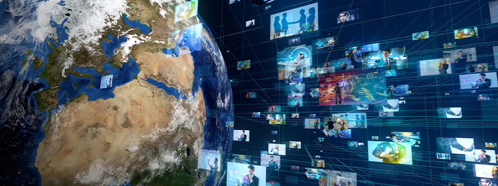
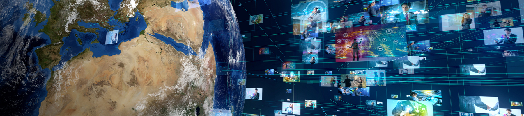
Natural disasters are becoming more and more severe every year, but various technologies can help minimize the damage they cause. The ASNARO-2 satellite, launched by NEC in 2018, has the potential to play an important role in disaster prevention. Takakazu Ishii, Senior Expert at NEC's Radio Application, Guidance and Electro-Optics Division, discusses the potential of Synthetic Aperture Radar (SAR) technology, which images the earth using the satellite's embedded radar.
SAR Technology Demonstrates Promise in the Fields of Disaster Prevention and Mitigation
Recently, typhoons, heavy rains and other natural disasters caused by climate change occur almost every year in Japan, and experts frequently point to the potential for a large earthquake to occur in future. Data must be put to use in order to curb the damage and save as many lives as possible.
The data that forms the basis for evacuation orders and advice by municipal and district authorities can include not only weather information, but also information such as increase in river levels and danger of landslides. Much of this data is gathered visually by personnel on the ground. However, surveying disaster-stricken areas can be very dangerous, and in some cases damage to roads renders sites inaccessible. One way to address this problem is by the use of satellites.
"We're currently working on disaster prevention and mitigation using SAR technology," says Takakazu Ishii.
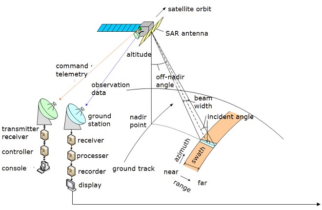
"SAR stands for synthetic aperture radar. As the radar-equipped satellite orbits the earth, a small antenna in the aperture transmits microwaves to the area under observation and receives the signals that are returned. This creates a virtual large-aperture antenna that transmits and receives microwaves. That's why it's called synthetic aperture radar. The earth receives microwave transmissions from SAR, and the echoes from the target are used to generate an accurate image."
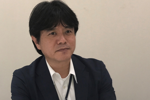
Senior Expert at NEC's Radio Application, Guidance and Electro-Optics Division
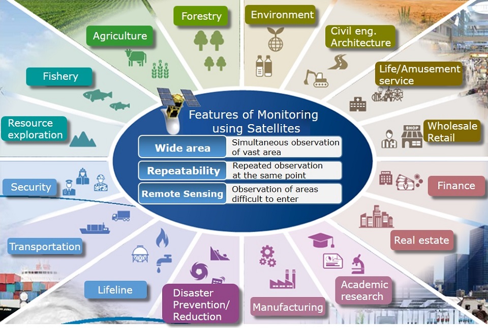
"SAR can take in an area of tens of miles to hundreds of miles at once," says Ishii. "By looking at the images generated over time, we can see things like topographical changes and increases in river levels."
 Larger view
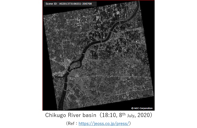 Larger view
Successful Launch of Japan's First Commercial SAR Satellite
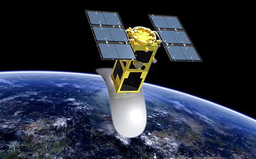
SAR technology was originally developed in the 1960s for ocean surveillance. NEC ventured into the research field in the ‘70s, and in 1980 was the first in Japan to successfully reproduce images from SAR data. Since then, NEC has provided its technologies to organizations including the Japan Aerospace Exploration Agency (JAXA). Another national first came in 2018, when NEC launched the commercial satellite ASNARO-2, the only Japanese satellite equipped to perform satellite operation and image generation and analysis in a single system.
"The SAR satellite takes around 100 minutes to orbit the earth in the south-north direction, and arrives back to exactly the same position roughly every two weeks. Its orbit is almost perpendicular to the direction of rotation of the earth, so in the course of around two weeks we can observe any spot on the earth's surface again under exactly the same conditions. SAR has come to be used in everything from ocean surveillance to forest management, resource surveying, civil engineering, and maintenance and management of infrastructure such as power stations and bridges. The biggest advantage of SAR is that it uses microwaves, so it differs from optical observation in that it works both day and night and can penetrate through cloud and smoke. We've had a lot of interest from overseas, and the technology is currently being considered for a cooperative project related to Russia's natural-gas industry, involving monitoring changes in the earth's crust. We're also making progress working alongside overseas consulting firms."
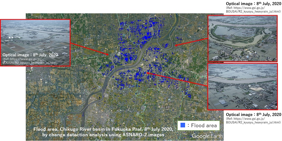
ASNARO-2 has achieved extraordinary results in the roughly two years since its launch. In Japan, it has been used for emergency monitoring of landslides caused by the Hokkaido Eastern Iburi Earthquake in September 2018, monitoring the eruption of Mount Shinmoedake in Kyushu, also in 2018, monitoring damage from Typhoon Hagibis in various areas of Japan in 2019, and monitoring the Kuma River flooding in Kumamoto Prefecture in 2020. The SAR images can be combined with other data to enable an accurate understanding of the situation, and a portion of the images taken through emergency monitoring are used by those in the affected areas under the auspices of the disaster-prevention agencies.
(Ref:
 https://jeoss.co.jp/)
Data Gathered in Ordinary Times Helps in Times of Disaster
When a disaster occurs, the most recent SAR images from before the disaster can be used for reference, allowing things like changes in topology, increased river levels, and changes to the coastline to be visualized. The SAR images also allow the detection of damage to major roads and railways. However, the technology does have its challenges.
"If we want to use recent SAR images for reference to see what's changed in a disaster, we need images that have been taken under exactly the same conditions. It takes time for the SAR satellite to return to exactly the same position in the sky above the area you want to monitor. This is currently the biggest challenge for all involved with SAR. At best, it can take two or three days before an image is generated, and that becomes around five days when you factor in the time needed for image analysis. It's often said that the first 72 hours after a disaster is critical. Most missing people who are rescued are saved within the first 72 hours. At the moment, it's difficult to overcome this barrier."
Ishii suggests that SAR has other potential applications.
"At the moment, SAR can be used effectively for disaster prevention by making use of data collected during ordinary times," says Ishii.
"Using SAR images, we can analyze chronological changes in high resolution and anticipate which areas are likely to incur heavy damage. This is not possible through visual observation on the ground. The analysis results can be combined with hazard maps and evacuation maps to simulate disasters, helping to mitigate the scale of the damage. That's our vision for right now."
NEC excels in image-analysis technology
"It's possible to improve the accuracy of the analysis even further by using AI with the basic image-analysis technology. In 2019, NEC's image-analysis technology was awarded the “Advanced Technology Award”. This prestigious award is sponsored by the Japan Ministry of Education, Culture, Sports, Science and Technology and the Ministry of Economy, Trade and Industry, and presented by the business newspaper Fuji Sankei Business Eye."
Ishii says a technological approach involving image generation and analysis using SAR can provide a foundation for a more safe and secure municipal development.
"We believe that SAR technology is absolutely essential for improving the resilience of smart cities, which are built using things like network technology, IoT and AI. We're currently collaborating with an internal department running a smart-city project to create ways in which SAR can be used in urban planning."
Four Areas of Co-Creation for Full Application of SAR
Of course, NEC is not alone in its challenge of using satellites for disaster-prevention initiatives. Currently, SAR is involved in four areas of co-creation.
The first is with energy companies and communications companies. The biggest potential benefit is that these companies can use SAR as part of their business continuity plans (BCP), which affects the BCP of communities as a whole.
The second is with venture companies. Many venture companies, both in and outside Japan, are planning to launch compact SAR satellites between 2025 and 2030 which encompass disaster prevention. The number of satellites is expected to rise from 30 to 100.
"The increased number of satellites will solve the problem of image generation not being in real-time. If there are 100 SAR satellites, it should be possible to shorten the time between image generation and analysis to just half a day."
The third is cooperation with data-platform companies. SAR images can provide even more powerful disaster-prevention solutions when combined with weather data and geological data. In order to build data-sharing platforms, cooperation with data-platform companies is essential.
Lastly, the fourth is co-creation within the company itself. Ishii discusses his desire to further improve the value of SAR through collaboration with other groups so as to leverage the Japan EO Satellite Service, Ltd., responsible for the operation of ASNARO-2 and the sale of image data, to Japanese and overseas companies involved with smart cities.
"Since 2014 we've been working on creating projects that use satellites. When starting a new line of business, you have to overcome various hurdles one by one: in terms of technology, the business model, the company's internal organization and so on. Building a business is not an easy thing to do, but giving up now would mean all our efforts have been wasted. We want companies and civil authorities both in Japan and abroad to be able to make use of satellite SAR technology. And through strategic collaboration, we want this technology to become the foundation of a safer and more secure society. We will continue to work harder so as to achieve these goals."
(September 18, 2020)