Global Site
Breadcrumb navigation


Disaster preparedness
Latest information
-
News
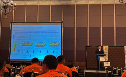 March,14,2025NEC to Exhibit and Introduce Disaster Preparedness Solutions at 2024 International Fire and Disaster Prevention Forum
 -
Press Release
 July 16, 2024NEC technology reliably measures sea levels from a greater distance
 -
Press Release
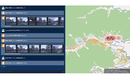 August 25, 2023NEC develops technology for disaster damage assessment using a Large Language Model (LLM) and image analysis
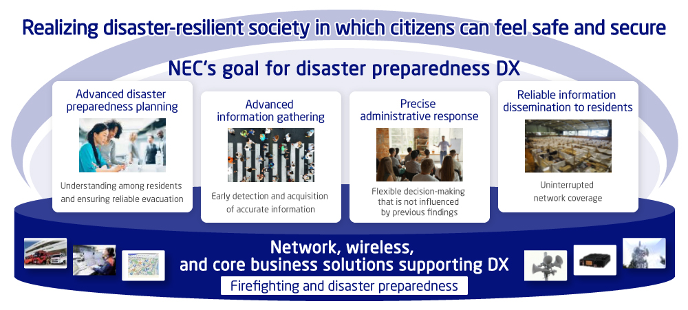
Disaster preparedness DX that NEC aims for
In recent years, natural disasters such as earthquakes and heavy rainfall and typhoons associated with climate change have been occurring more frequently and with greater severity, deepening their social and economic impact. Based on its long-standing expertise and knowledge in the firefighting and disaster-prevention fields, NEC utilizes cutting-edge technologies such as AI, IoT, and image analysis, thereby assisting in detecting signs of disasters before they occur, assessing situations during disasters, and enhancing information sharing with relevant organizations. Through these efforts, NEC strives to realize a disaster-resilient society in which citizens can feel safe and secure.
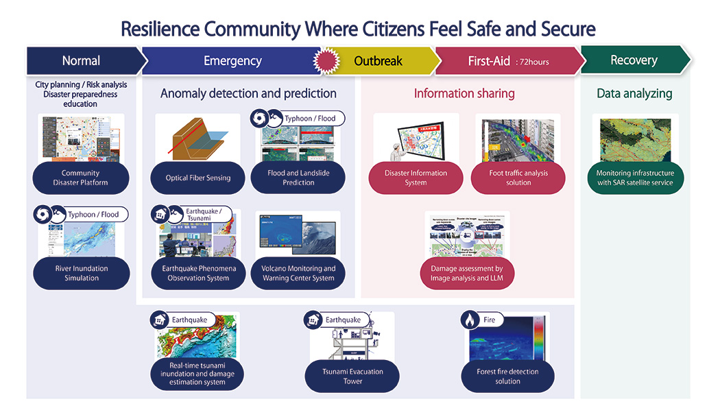
NEC's disaster preparedness solutions
At NEC, we provide comprehensive Disaster Prevention DX solutions designed for an integrated approach across various stages: normalcy, emergency, first-aid, and recovery phases. Our solutions ensure seamless operation throughout these stages.
For detailed information and tailored guidance on implementation based on your specific country or region, please don’t hesitate to reach out to us.

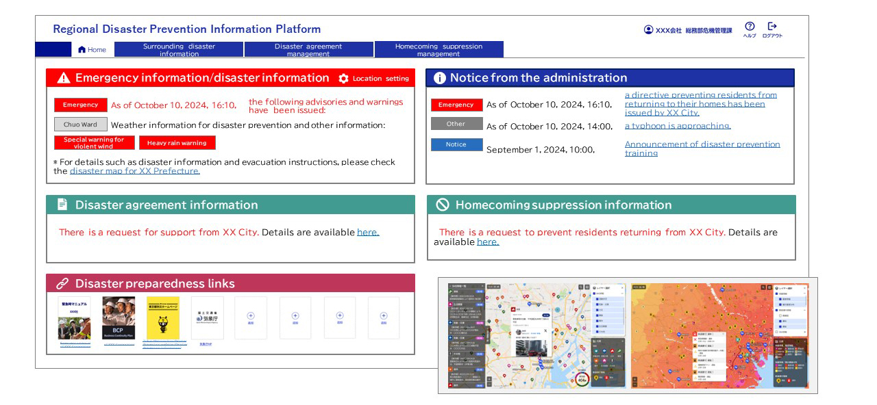 Regional Disaster Prevention Information Platform
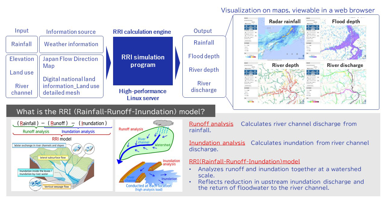 River Inundation Simulation
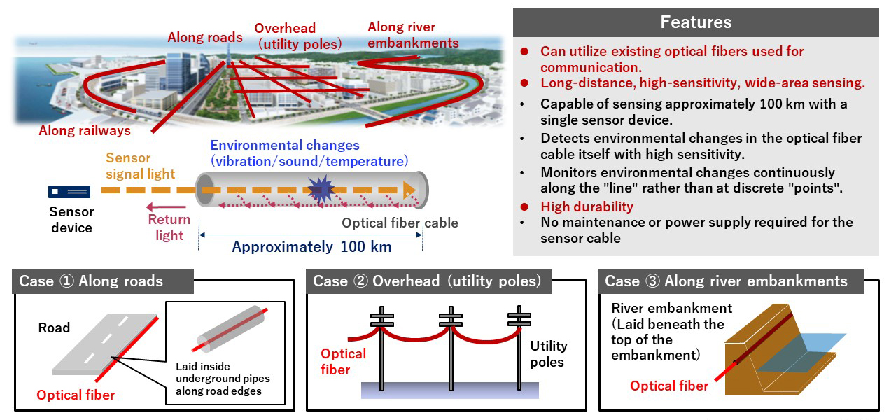 Optical Fiber Sensing
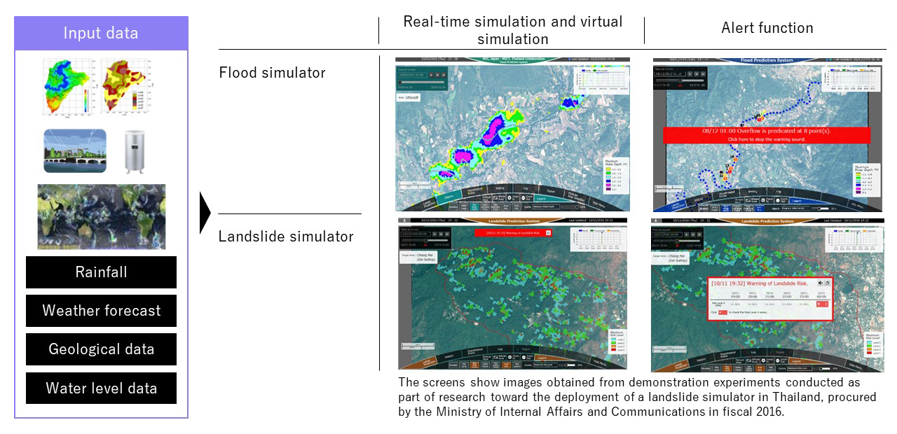 Flood and Landslide Simulation
 Real-Time Tsunami Inundation and Damage Estimation System
 High-Functionality Tsunami Tower
 Forest Fire Detection Solution
 Disaster Prevention Information System
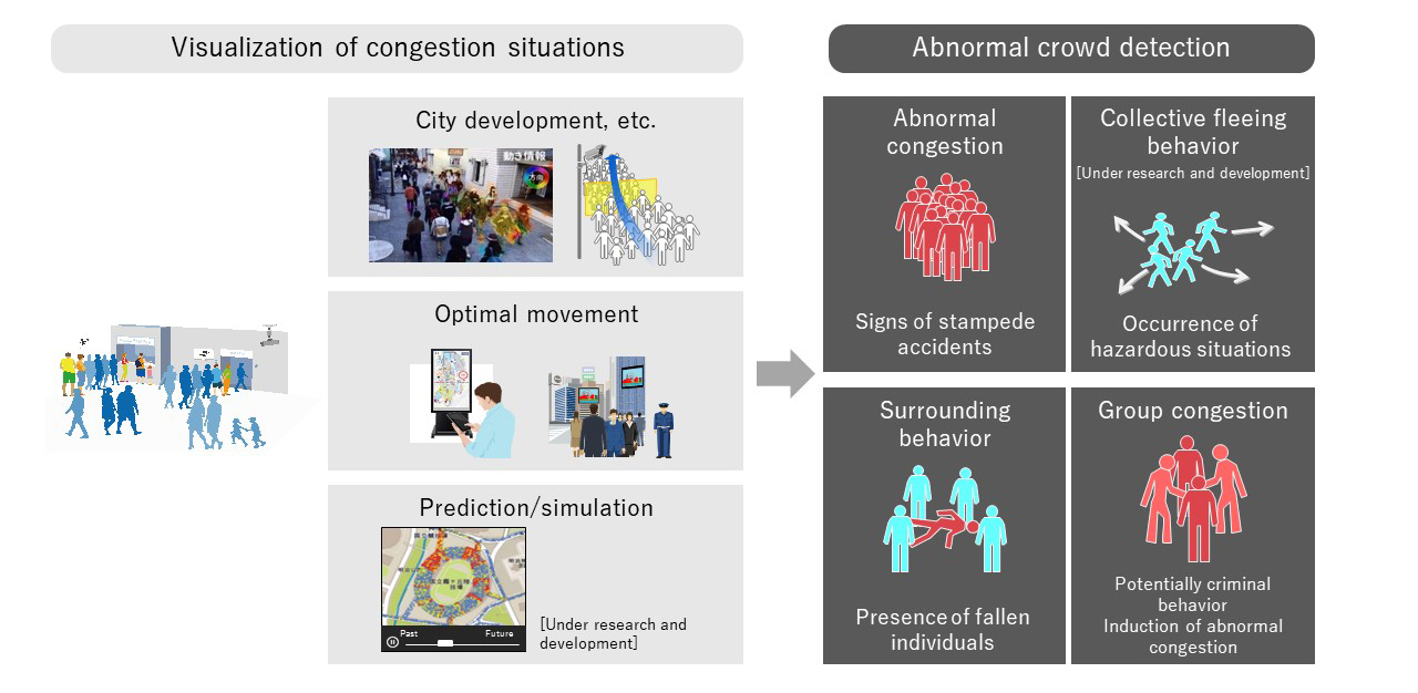 Foot Traffic Analysis (Crowd Behavior Analysis) Solution
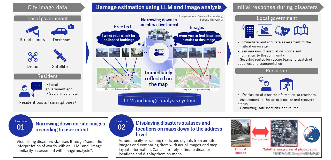 Damage Assessment Using Image Analysis and LLM
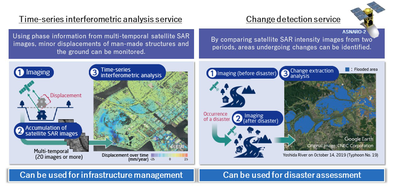 Infrastructure Monitoring Service with Satellite SAR
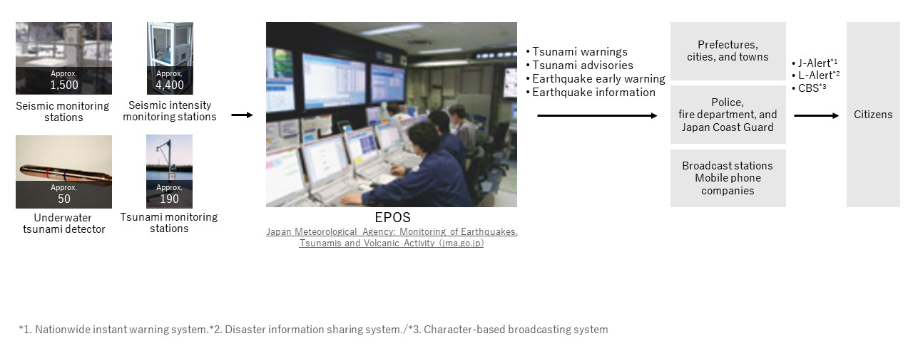 Earthquake Phenomena Observation System (EPOS)
 Volcanic Observations Information System in Japan
Regional Disaster Prevention Information Platform

Solution Overview
Given the increasing frequency and severity of disasters in recent times, close collaboration between local governments and private enterprises is essential to ensure regional disaster preparedness. The "Regional Disaster Prevention Information Platform" uses digital transformation (DX) for interaction between local governments and private enterprises that have concluded "disaster support agreements", which include the provision of supplies, emergency transportation, and the provision of temporary accommodation facilities, thereby supporting the efficiency of recovery and reconstruction operations during a disaster.
River Inundation Simulation

Solution Overview
By utilizing the "Rainfall-Runoff-Inundation (RRI) model" high-speed algorithm, jointly developed by Mitsui Consultants Co., Ltd. and the Disaster Prevention Research Institute of Kyoto University, the impact on rivers and other waterways during heavy rain is calculated in real-time, providing web-based simulation information on river inundation several hours in advance.
Optical Fiber Sensing

Solution Overview
The sensor device automatically detects vibrations and other disturbances in the optical fibers used for communication, enabling real-time remote assessment of anomalies in infrastructure such as roads, river embankments, and power lines, as well as disaster-affected areas.
Flood and Landslide Simulation

Solution Overview
Based on the weather, terrain, and river data, simulations are conducted to predict flooded areas, maximum flood heights, etc. Simulations can be performed hourly up to 7 days in advance.
Press Release
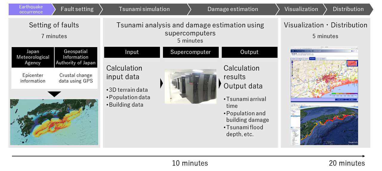
Real-Time Tsunami Inundation and Damage Estimation System

Solution Overview
This system performs fault estimation, tsunami analysis and damage estimation, visualization, and distribution within as little as 20 minutes after an earthquake occurs. It contributes to efficient and appropriate disaster response and victim relief efforts based on these estimation results.
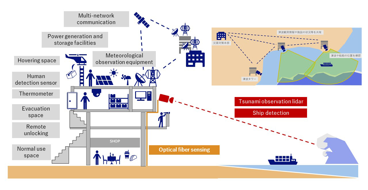
High-Functionality Tsunami Tower

Solution Overview
By installing tsunami observation lidar on tsunami towers (temporary evacuation facilities) constructed along the coastline, the early detection of tsunami is possible. Additionally, building damage can be detected using optical fiber sensing. In the event of anomaly detection at the tsunami tower, the prompt sharing of information with the disaster response headquarters enables swift decision-making.
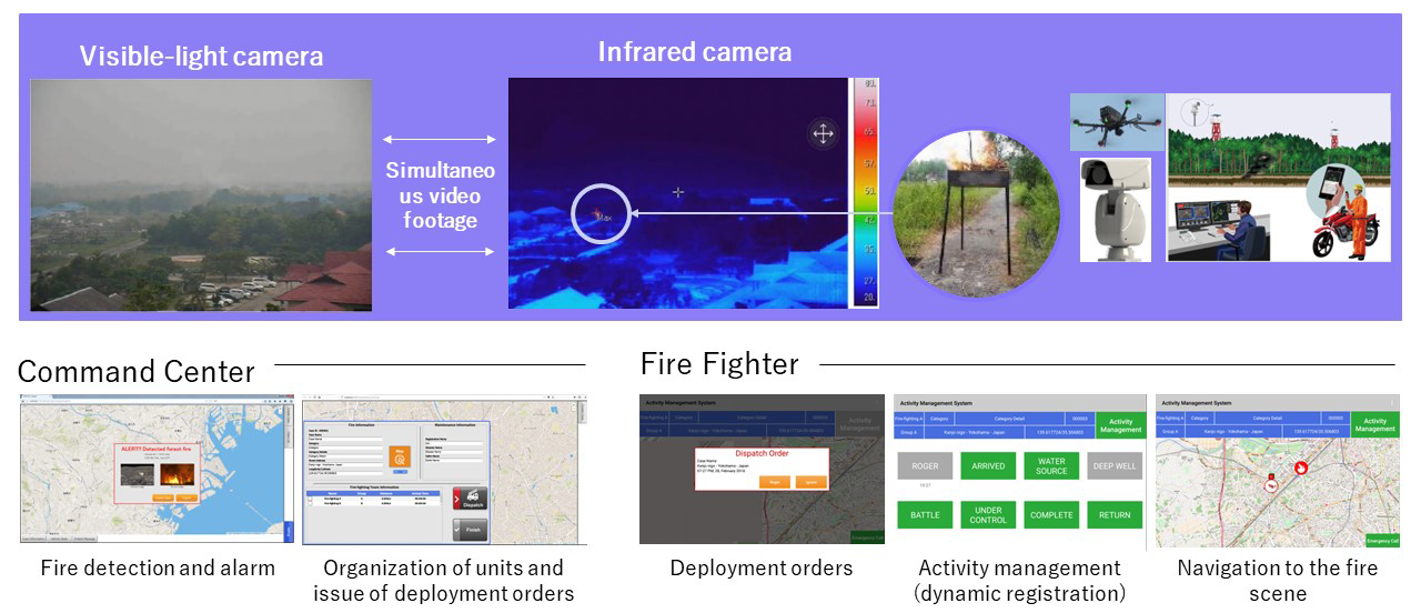
Forest Fire Detection Solution

Solution Overview
This solution detects heat sources that are not visible to fixed visible-light cameras, using infrared cameras and drones, thus hastening the suppression of large-scale fires. This streamlines deployment orders for firefighting units and enables activity management via tablets.
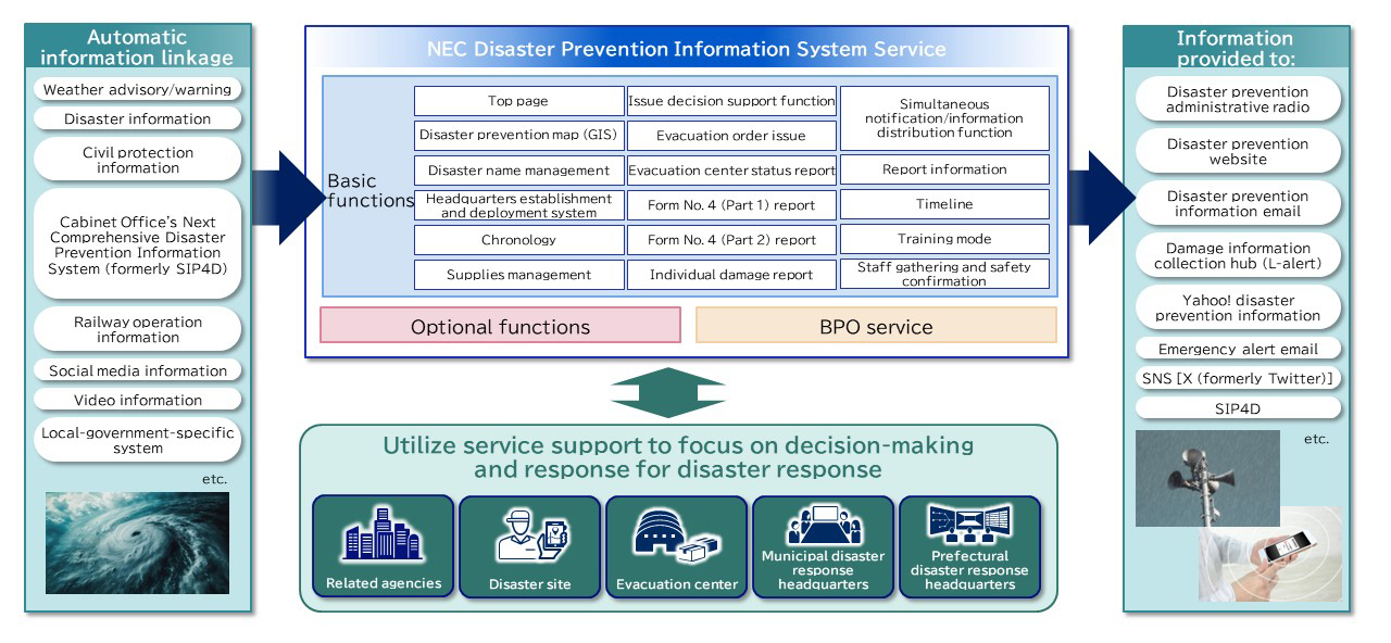
Disaster Prevention Information System

Solution Overview
To facilitate disaster response by local governments (prefectures, cities, towns, and villages), this system collects information on weather, observations, damage, and other relevant aspects to swiftly assess the situation and facilitate precise emergency measures and critical decision-making and supports swift decision and response at the disaster response headquarters. In addition to the information input manually by field staff, incorporating external dynamic data enables an advanced disaster response.
Foot Traffic Analysis (Crowd Behavior Analysis) Solution

Solution Overview
Using image analysis, this solution can analyze gatherings of people as crowds, visualize congestion situations, estimate foot traffic, and detect abnormal crowd behavior. By predicting how crowds behave during disasters and estimating the number of people unable to return to their homes, you can implement appropriate evacuation guidance and rescue operations. By using the gathered information in guidance by security personnel and presenting the information to users through smart devices, digital signage, etc., the optimization of movement is also possible.
Damage Assessment Using Image Analysis and LLM

Solution Overview
Through the use of a large-scale language model (LLM) and image analysis, the solution can promptly and accurately assess disasters statuses and locations from extensive disaster location image data gathered upon the occurrence of a disaster. This supports swift and crucial decision-making by the disaster response headquarters of the relevant ministries and local authorities during initial responses. The solution enables the monitoring of "towns" not only during disasters but also on a day-to-day basis, thus realizing phase-free usage.
Press Release
Infrastructure Monitoring Service with Satellite SAR

Solution Overview
Using SAR technology, which generates ground images using radar mounted on satellites, this service enables wide-area disaster monitoring, the measurement of lifeline ground changes, the assessment of wind and flood damage, environmental pollution monitoring, and more.
Earthquake Phenomena Observation System (EPOS)
Anomaly detection and prediction

Solution Overview
Analyzing earthquake and tsunami data, as well as crustal changes, the system efficiently disseminates disaster prevention Analyzing “real-time” earthquake information to the public via national ministries, local governments, and news organizations*4.
*4. Now in its sixth generation, NEC has developed the system since its second iteration.
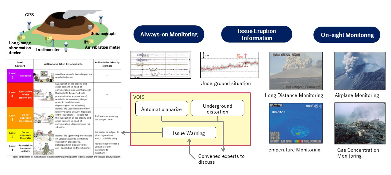
Volcanic Observations Information System in Japan

Solution Overview
VOIS processes observation data transmitted from various observation equipment installed at volcanoes across the country in real time and monitors volcanic activity always-on. In the event of increased volcanic activity, it immediately issues eruption risks, warnings, explanatory information, etc., to support appropriate disaster prevention activities by disaster prevention organizations of local governments and other organizations.
Related news
- July 16, 2024
- Press Release
- August 25, 2023
- Press Release
Contact Us


