Global Site
Breadcrumb navigation
Global Navigation Satellite System
Nowadays, we count on our smartphones and automotive navigation systems to determine our current location. Michibiki, a Quasi-Zenith Satellite System, provides highly accurate location information down to the centimeter. So how do satellites obtain location information? In addition to answering this question, we’ll share how NEC has been involved with Michibiki.
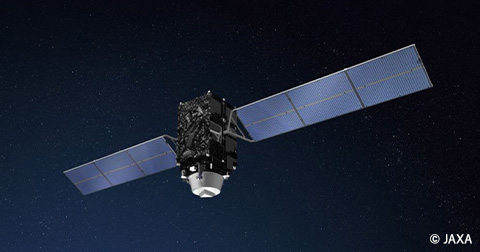
Michibiki—the Japanese version of GPS
Simply put, Michibiki is the Japanese version of the Global Positioning System (GPS). It provides more accurate and reliable location information services by positioning satellites launched into what is known as a quasi-zenith orbit(*) drawing a figure eight almost directly above Japan.
- *Although these satellites orbit the earth, they appear to be flying in a figure-eight orbit when viewed from the earth’s surface. This orbit is referred to as a quasi-zenith orbit.
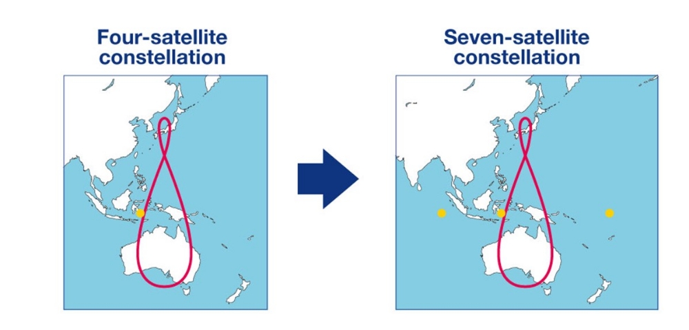
The Quasi-Zenith Satellite System known as Michibiki is currently operated as a four-satellite constellation, complementing and reinforcing U.S. GPS satellites. Going forward, plans are slated to sequentially launch three additional satellites to create a seven-satellite constellation. Once this seven-satellite constellation has been established, Japan will be able to independently provide positioning services without having to depend on U.S. GPS satellites. This is anticipated to facilitate further utilization of location information services.
For Michibiki to become a seven-satellite constellation, one additional satellite will be placed in the quasi-zenith, geostationary, and quasi-geostationary orbits, respectively. The addition of these three satellites will expand the range of coverage for signals transmitted by Michibiki.
・Provided by: National Space Policy Secretariat, Cabinet Office
How do satellites measure location information?
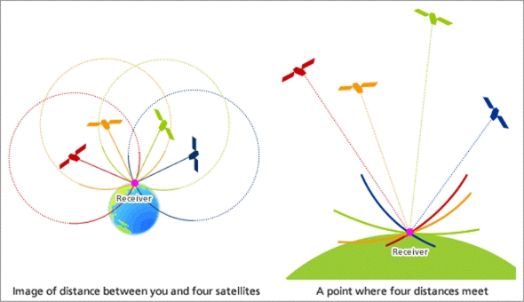
The term “positioning” means to measure the location of an object. Users receive positioning signals from four satellites, and the distance between them and the satellites is then measured.
You cannot pinpoint your current location by simply determining the distance between yourself and one satellite. To do so actually requires four satellites. First, the distance between yourself and each of the four satellites is calculated. Once these distances have been calculated, you can find the point where the four distances meet. This is how satellite positioning is used to determine your current location.
 https://global.jaxa.jp/countdown/f18/overview/gps_e.html
NEC and its involvement with Michibiki
NEC has been responsible for the development and fabrication of the positioning mission payload since the launch of the first satellite. The positioning mission payload—a set of key instruments used to realize satellite positioning services—is comprised of instruments that generate positioning signals and measure distances, communications equipment that transmits positioning signals to the earth, and more.
Once a satellite has been launched into space, maintenance cannot be performed on it for ten or more years. It is therefore necessary to take into account age-related degradation, temperature fluctuations, and exposure to radiation that may occur during that time, incorporate ways to minimize and compensate for errors in the design, and know how to keep the situation under control from the ground. By doing so, Michibiki has become the world’s most accurate quasi-zenith system among the countless positioning satellites around the globe.
Utilization of satellite positioning services
Michibiki’s satellite positioning services are used daily in smartphones and automotive navigation systems. In fact, as of the end of fiscal year 2023, as many as 429 products were compatible with Michibiki. In addition, the positioning reinforcement service capable of attaining positioning accuracy to the level of a few centimeters is currently undergoing field trials aimed at automating the operation of cars and agricultural machinery, with part of the service already being put to practical use. Achieving even higher accuracy will make it possible to provide comprehensive services in automotive, drone, logistics, and other fields, raising expectations for it to become an indispensable infrastructure for industrial promotion.
January 22, 2025