Global Site
Breadcrumb navigation
Monitoring volcanic activity from space:
How the climate change observation satellite SHIKISAI helps minimize the devastating effects of volcanic eruptions
Interview 
If you live in a seismically active country, the threat of volcanic eruptions and earthquakes is ever present. Minimizing the havoc caused by volcanic activity requires detecting warning signs of an impending eruption and promptly evacuating people when one occurs. Satellites have lately come to play an important role in that regard. The climate change observation satellite SHIKISAI developed and operated by NEC is one such satellite.
How exactly does SHIKISAI monitor volcanic activity and help prevent or mitigate its devastating effects? For answers, we turned to an expert: Associate Professor Takayuki Kaneko of the Volcano Research Center, part of the University of Tokyo’s Earthquake Research Institute (ERI).
Takayuki Kaneko
Associate Professor at the University of Tokyo’s Earthquake Research Institute (ERI). Professor Kaneko, who has a doctorate in science from the University of Tokyo, is an expert on the application of remote sensing to volcanology and volcanic petrology. He does research on the geology and petrology of Mount Fuji and other volcanoes. He also studies the eruption process by conducting near-real-time observations on 167 active volcanoes in the Asia-Pacific region; for this he uses an observation system fed data from satellites like Himawari and SHIKISAI. Meanwhile he is working on developing a system for observing volcanic craters close up using remote-controlled helicopters and drones.
Living in the shadow of a volcano
Mount Ontake, on the border between Nagano and Gifu prefectures in Japan, erupted in September 2014. That eruption, which left 63 people dead or missing, is remembered as the most lethal in postwar Japanese history.
Japan’s volcanoes tend to be located in picturesque surroundings that attract legions of sightseers. Most of the victims of the Mount Ontake eruption were hikers. Often a volcano is near an inhabited area, and many people lead their lives in its shadow.
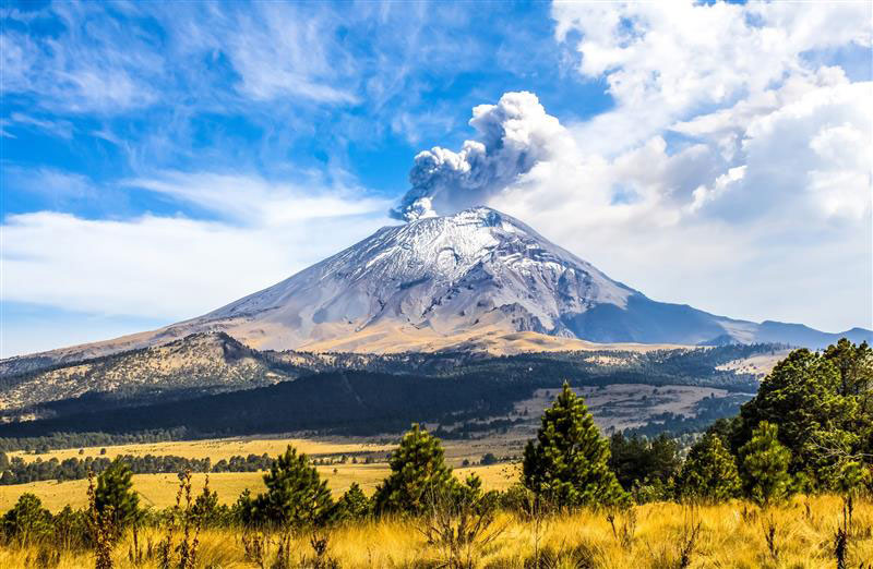
The same is true in other countries where there are volcanoes. Naples at the foot of Mount Vesuvius in Italy, for example, is home to almost a million people. Mount Vesuvius is the volcano that famously buried the ancient city of Pompeii in ash and rock when it erupted in AD 79.
“An eruption like that would claim many victims if it happened today. That’s why detecting signs of volcanic activity is such an important undertaking worldwide. It protects people’s lives.”
So explains Associate Professor Takayuki Kaneko of the University of Tokyo’s Volcano Research Center, part of the University of Tokyo’s Earthquake Research Institute (ERI). Professor Kaneko is a member of a research team that has twice won the Outstanding Paper Award of the Volcanological Society of Japan for several studies elucidating the mechanism of the Mount Ontake eruption.
Research on volcanic activity is necessary not only to predict eruptions but also to minimize their human toll. When a volcano erupts, it spews lava bombs, generates pyroclastic flows, and wreaks havoc over a vast area. In June 1991, the Fugen-dake peak of Mount Unzen in Nagasaki Prefecture produced a pyroclastic flow that consumed everything in its path like some living beast. The news footage of it spreading across the mountainside is still seared in the memories of many people in Japan today. When a similar disaster strikes, the Volcano Research Center promptly goes into action. It ascertains the nature of the volcanic activity and supplies the information needed to evacuate people and mount a rescue operation. That is an integral part of its mission.
The ability to discern features as small as 250 m across from space
The Volcano Research Center was formed in 1990 through the merger of two research departments, one devoted to volcano physics, the other to volcano geology. It currently has observatories on Mount Asama, on the island of Izu Oshima, in the Kirishima range, and elsewhere in Japan. These regularly monitor tremors and movements in the earth’s crust. Professor Kaneko, a geologist by training, is now engaged in research on the application of satellites to remote sensing.
“Satellites are increasingly being used to monitor volcanic activity. The most common method these days is SAR, but using infrared rays for observation purposes has become more widespread over the past few years. I’m mainly working on the utilization of infrared rays.”
SAR is a technology for generating images by beaming microwaves from a satellite and picking up the waves that bounce back from objects on the ground. This technique can detect movements in the earth’s crust to within a few centimeters. Satellites equipped with SAR sensors include the Advanced Land Observing Satellite DAICHI-2 (ALOS-2) operated by JAXA and the earth observation satellite ASNARO-2 developed and operated by NEC.
A well-known example of a satellite equipped with an infrared radiometer, on the other hand, is Himawari 8, a weather satellite launched by the Japan Meteorological Agency in 2014. Himawari 8 is a geostationary satellite: it has a period of rotation synchronous with that of the earth on its axis, so that it appears to be stationary from the earth’s surface. It can observe volcanic activity once every ten minutes in East Asia, and once every 2.5 minutes in Japan. It has a spatial resolution of two kilometers (resolution being the precision with which a sensor or other device is able to distinguish and measure an object). That is far higher than any weather satellite previously built in Japan.
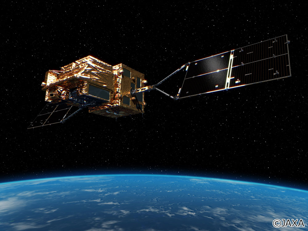
But there is now a satellite with a considerably higher resolution than Himawari 8: the climate change observation satellite SHIKISAI developed and operated by NEC, which also performs initial processing of the data it collects. SHIKISAI, launched in 2017, is equipped with a second-generation global imager (SGLI) with a spatial resolution of just 250m. That enables it to provide a detailed picture of cloud formations, atmospheric dust, the color of seawater, vegetation, snow and ice, and even the temperature of the land and ocean surface. It takes observations once every two days, depending on the weather.
“Almost all previous satellites either had a high resolution but a low observation frequency, or vice versa,” says Professor Kaneko. “There’s never been a satellite before with a resolution and observation frequency that are both relatively high. SHIKISAI’s main mission is collecting data on climate change, but with its impressive capabilities, it’s also invaluable for observing volcanic activity.”
 Large view
Simulating the extent of the damage from an eruption
SHIKISAI really comes into its own when you are trying to assess the nature of a volcanic eruption, according to Professor Kaneko.
“When a volcano erupts, experts like us should ideally visit the site to size up the situation. But access to areas of volcanic activity has come to be severely restricted in recent years to prevent casualties. Nor is it easy to inspect the site by plane or helicopter, because of the danger of an explosive eruption. And if the volcano is on a remote island, it takes ages to reach it in the first place. Which means that satellite observation is virtually the only way to collect detailed information on an eruption.”
SHIKISAI’s 250m resolution is crucially important in this regard. The lava flows produced by an eruption advance across a front of at least 2-3 km. A spatial resolution of, say, 2 km, only gives you an overall idea of their movement. But SHIKISAI with its 250m resolution provides a more detailed picture of the pattern of lava flows. SHIKISAI has another unique advantage, Professor Kaneko points out. It enables you identify to the site of the eruption with considerable precision.
“If you can pinpoint the site of the eruption, you can forecast the movement of lava flows from it. How much lava will there be? In what direction will it flow? At what speed? We can more or less predict that by plugging information from SHIKISAI into our own simulations.”
The Volcano Research Center’s scientists spend their days trying to better understand the character of Japan’s major volcanoes. They analyze the topography of each, the properties of its magma, and its history of past eruptions. Professor Kaneko terms these features of a volcano its “idiosyncrasies.” By collating those idiosyncrasies with the data on the eruption site and lava flows supplied by SHIKISAI, scientists can predict the likely extent of the damage. That in turn enables evacuation and rescue operations to be promptly carried out. Thus the toll in human lives can be kept to a minimum.
Placing volcanologists’ knowledge at the service of society
Besides a high spatial resolution, another hallmark of SHIKISAI is its high temperature resolution. Its onboard SGLI sensor can detect changes in surface temperature to an accuracy of 0.5˚C. Considerable progress has been made in experimenting with ways of exploiting that precision to observe volcanic activity more closely.
Indonesia is another country that experiences a lot of volcanic activity. In 2019, Professor Kaneko used data from SHIKISAI to observe the Ijen crater lake near the summit of the Ijen volcano on the Indonesian island of Java.
“The Ijen crater lake has a diameter of 900 m. SHIKISAI can accurately measure changes in the surface temperature of a lake of that size. A sensor with a resolution of two or four kilometers, though, would register the land temperature at the same time, making it difficult to determine the exact water temperature.”
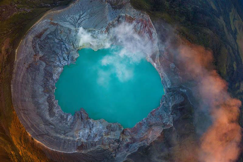
Professor Kaneko’s observations revealed a significant rise in the lake’s surface temperature at one point. Although no eruption ensued, this did demonstrate that monitoring temperature changes could be an effective means of identifying telltale signs of volcanic activity.
“It should be possible to detect signs of undersea volcanic activity in a similar way, by using SHIKISAI to monitor changes in seawater color and temperature,” explains Professor Kaneko.
Satellites will, as their resolution gets even better, soon be useful for taking surface observations of relatively small crater lakes in Japan. As more satellites with equivalent capabilities are launched, it will become possible to conduct observations more often. That will dramatically enhance the accuracy with which volcanic eruptions can be predicted.
“Satellites let you observe the activity of volcanoes worldwide,” Professor Kaneko notes. “Using satellites to gather data on volcanic activity in other countries will lead to new advances in volcano research. Remote sensing by satellites is an indispensable technology for volcanologists. It will enable us to gain further knowledge and place that knowledge at the service of society. So I firmly believe.”
NEC once worked with the University of Tokyo’s Earthquake Research Institute (ERI) on developing a system for imaging the interior of structures; this employs a visualization technology called muon tomography, which harnesses cosmic rays. NEC intends to continue supporting the ERI’s activities in the field of satellite observation of volcanic activity.
Takahiro Amano of NEC’s Space Systems Division, project manager for development and operation of SHIKISAI’s onboard SGLI, puts it this way.
“Satellite technology is extremely useful for predicting volcanic eruptions and earthquakes, and for gathering information after an eruption. When that knowledge can be utilized to prevent or mitigate disasters, satellites will truly have become one of the technological underpinnings of society. We genuinely believe that. We’re committed to working for the safety and security of society by pursuing technological excellence and forming creative partnerships with academia.”
Published March 23, 2021