Global Site
Breadcrumb navigation
How the climate change observation satellite SHIKISAI is helping ice scientists fight global warming
Interview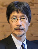
Global warming has triggered many abnormal changes in the earth’s environment. Among them are rising sea levels, caused in part by the melting of the Arctic and Antarctic ice sheets. Why is snow and ice melting in the polar regions? And what can be done to stop the thaw? Teruo Aoki, professor at the Arctic Environment Research Center of the National Institute of Polar Research, has spent many years studying the Greenland ice sheet in the Arctic. Here he explains the exact mechanism whereby ice sheets melt. He also describes the role that satellites play in observing the melting process and developing predictive models of its future course.
Teruo Aoki
After graduating from the Meteorological College in 1981, Teruo Aoki worked at the Japan Meteorological Agency’s Chitose Aviation Weather Station and Sapporo Observatory. He became a researcher at the Meteorological Research Institute in 1985 and was later appointed Head of Laboratory. In 2016, he became Professor in the Graduate School of Natural Science and Technology of Okayama University. He has been Professor at the Arctic Environment Research Center of the National Institute of Polar Research since March 2019. He has received awards from such bodies as the Japanese Society of Snow and Ice and the Meteorological Society of Japan.
Why is the Arctic ice sheet melting?
-Could you explain the state of global warming from an ice scientist’s perspective?
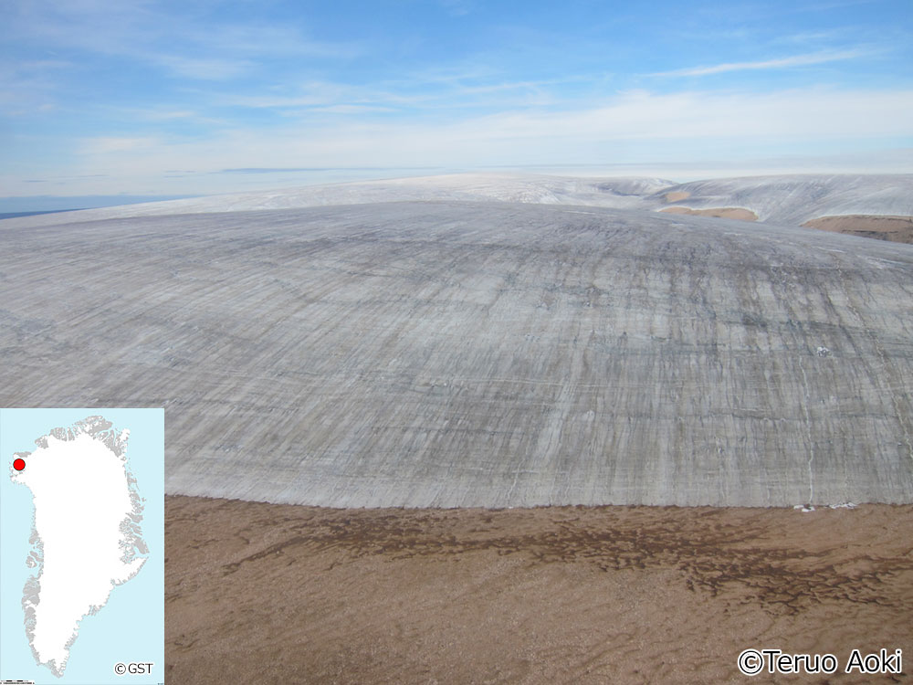
TERUO AOKI: In the century between 1900 and 2000, average temperatures worldwide rose by roughly 1.0˚C, while average sea levels rose between 15 and 20 cm. About half that rise in sea level is attributable to thermal expansion caused by rising ocean temperatures. But another factor can be cited: the melting of the Arctic Greenland ice sheet, the Antarctic icesheet, and mountain glaciers.
About 90 percent of the ice on Earth is in the Antarctic. Most of the rest is in Greenland. The Greenland ice sheet, which accounts for 9 percent of all the ice on Earth, is now shrinking at something like twice the speed of the Antarctic ice sheet. If the entire Greenland ice sheet were to melt away, sea levels would rise seven meters.
Why are ice and snow melting faster in Greenland and other parts of the Arctic than in the Antarctic? The reasons have yet to be fully understood. One plausible theory is this. The Antarctic consists of land surrounded by ocean. In the Arctic, conversely, the sea is in the middle, so that heat transfer by the atmosphere and ocean is greater.
-What will happen if seawater expansion and ice melt continue at their present rate?
AOKI: By 2100, sea levels will rise by 0.43 meters if serious action is taken to curb global warming, but by 0.84 meters if no such action is taken. That’s according to the Special Report on the Ocean and Cryosphere released in 2019 by the Intergovernmental Panel on Climate Change (IPCC). With a sea-level rise of 0.84 meters, in Japan, for example, even the inland regions of Tokyo would end up under water.
-What is causing the Greenland ice sheet to melt?
AOKI: In Greenland and the rest of the Arctic, temperatures have risen twice as fast as the global average over the past hundred years. When temperatures go up, ice and snow melt, exposing the surfaces of the ocean and land. Ice and snow have a high albedo — albedo is the proportion of sunlight reflected by a surface. The ocean and land surfaces, on the other hand, have a low albedo and absorb more solar radiation. Their temperature therefore rises. Another phenomenon is also at play: heat and water vapor from warmer regions accumulate at the poles. Those are the reasons why temperature changes are greater in the polar regions than elsewhere.
-So when ice melts due to global warming, the albedo declines, and the temperature rises even faster.
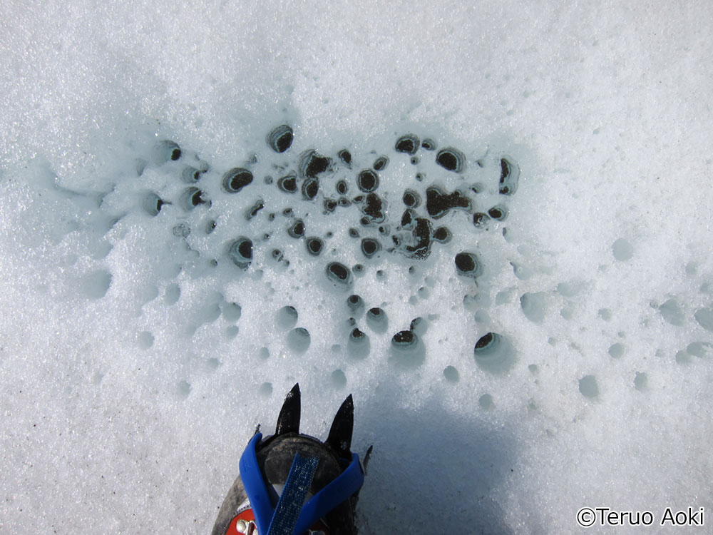
AOKI: Actually, the interplay between albedo and temperature increases is a bit more complicated than that. If snow on the ground becomes contaminated with black carbon (soot) contained in exhaust fumes, for example, its albedo declines. Similarly, snow with a larger grain size has a lower albedo, even if it looks like ordinary white snow. Fresh snow has small grains; but if it partially thaws as the temperature rises and then refreezes, it becomes what is popularly known as corn snow, which has a larger grain size. An increase in such coarse, granular snow is another impact of rising temperatures in the polar regions.
-So as fresh snow turns to corn snow, it tends to absorb more of the sun’s heat, even if it doesn’t melt.
AOKI: That’s right. The albedo of fresh snow decreases by about 10 percent when it turns to corn snow. It’s also been determined that cold-adapted microorganisms in the form of cryoconite lower the albedo by propagating on the surface of ice and snow. This is thought to be because warmer temperatures have created better reproductive conditions for them.
So warmer temperatures and other factors lower the albedo. That in turn leads to further warming in the polar regions. As a result, the melting of the ice sheet accelerates, and the sea level rises. That is the mechanism behind global warming, ice melt, and rising sea levels.
 Large view
 Large view
 Large view
Ongoing observations are needed over the long term
-What effects will global warming and ice melt have on our lives?
AOKI: For starters, certain places that are now dry land will sink under water, reducing areas of human habitation. That will increase the risk of tsunamis, storm surges, and other disasters. The economic impact will likely be huge as well, because much essential infrastructure like harbors and airports is located on the coast.
What’s more, rising water temperatures and other changes in the marine environment will, according to predictions, alter the circulation of the oceans. That will further disrupt the environment and impact ecosystems. It could also damage fisheries.
-What should be done, in your opinion, to stem the tide of global warming?
AOKI: The most urgent task is to cut emissions of substances that cause global warming, like greenhouse gases and black carbon. The work now being done in different countries on developing geoengineering technology for controlling the climate should also continue.
As an ice scientist, what I can do is assess how far the melting of the ice sheet has progressed. I can also help develop numerical models that will enable the most accurate possible forecasts. After all, having reliable forecasts makes it more likely that effective action can be taken to combat global warming. Satellite remote sensing is an indispensable technology to accomplishing this set of tasks.
-How is satellite remote sensing useful to ice scientists?
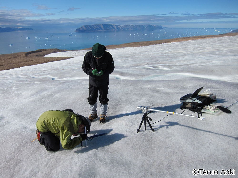
AOKI: Field observation is the cornerstone of our research on ice and snow. But that method doesn’t allow us to gather comprehensive data. That’s where satellites, with their ability to observe a wide expanse, play a crucial role. Remote sensing by satellites has assumed even greater importance since the spread of the novel coronavirus restricted access to the polar regions in 2020.
To develop a numerical model for generating forecasts, you need to accumulate very precise data. Collecting those data is a key function performed by satellites. It’s especially important to gather ongoing data over the long term. That’s because global warming doesn’t progress in a straight line, so patterns of change need to be accurately tracked by conducting long-term observations. In annual terms, some years are warmer, and some are cooler. But when you trace patterns over a decade or two, you realize that the cryosphere is changing over the long term.
-So you need to have an earth observation satellite up in orbit for the long term, right?
AOKI: Absolutely. Identifying changes in the cryosphere, understanding the physical mechanism behind them, and improving the accuracy of forecasts will, I believe, come to be key facets of ice science. That will take a combination of three things: observations on the ground, ongoing satellite remote sensing over the long-term, and numerical modeling.
Data from SHIKISAI improves the accuracy of climate change forecasts
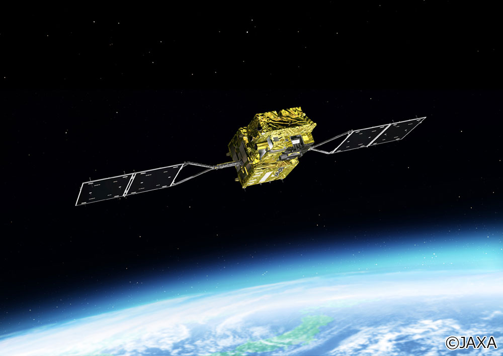
-How is SHIKISAI — the JAXA satellite Global Change Observation Mission-Climate (GCOM-C) — contributing to ice science?
AOKI: Until now, the data on ice and snow we’ve used have come mostly from the MODIS spectroradiometers for measuring visible and infrared radiation carried aboard NASA’s earth observation satellites Terra and Aqua. But the MODIS system first entered operation in 2000. It’s already been in use for over 20 years. So it could malfunction at any time. That’s why we’re looking to SHIKISAI to take over from MODIS.
Right now we’re comparing data from SHIKISAI with MODIS data and data collected on the ground. We think that SHIKISAI has the capabilities to replace MODIS as an observation system. And not just to replace it. SHIKISAI is markedly better than MODIS when it comes to spatial resolution. Spatial resolution means the smallest area that can be seen by a system. Most of the MODIS channels have a resolution of one kilometer, but SHIKISAI has a resolution of 250 meters. That means you can conduct detailed observations of, say, snow and ice cover and obtain much more information. Research on physical processes relating to ice and snow will progress as a result. Numerical models will become more sophisticated, greatly improving the accuracy of climate-change forecasts. That’s what we expect.
-What are your expectations of NEC, the developer and operator of SHIKISAI’s systems?
AOKI: MODIS has been conducting observations for over 20 years. We hope that SHIKISAI will remain operational for a similarly long time. To repeat myself, changes in the cryosphere and the advance of global warming can, to a very great extent, only be revealed through long-term observation.
Also, when a satellite is developed to replace SHIKISAI, the sensor should preferably be equipped with more channels than the present craft offers. The more channels there are, the more wavelengths you can use to conduct observations, and the more information you can collect. Another thing: given that global warming is progressing every day, satellite systems need to be developed faster.
Of course, it’s not up to NEC to decide all aspects of the satellite development, launch, and operation process. But we do hope that NEC will continue to provide technical backing to earth observation activities as a leading developer of satellite systems.
-Finally, what do you think the future holds for ice science?
AOKI: Ongoing research on snow and ice is now under way as part of  JAXA’s SHIKISAI project and the Ministry of Education’s Arctic Challenge for Sustainability II
  (ArCS II) project . The goal now is to improve the precision of numerical models through observations on the ground combined with satellite remote sensing, and thus come up with climate-change forecasts that are as accurate as possible. That pretty well sums it up.
A further goal, I should add, is to ensure that research on ice and snow continues by imparting observational techniques and know-how to a younger generation. I look forward to visiting Greenland as much as possible with young researchers and passing on the techniques of field observation to the next generation. I also want to mentor them to be all-rounders proficient in the use of satellite remote sensing and developing numerical models as well.
 Large view
Published March 26, 2021